Sunday, July 26, 2009
Preview - Table of Contents
Saturday, July 25, 2009
Welcome and Introduction
Illustrations from "Walden," by Henry David Thoreau, and "Lake Wobegon Days" by Garrison Keillor, two books and two places with much in common.
Long before our departure, however, I shifted the purpose toward environmental education and broadened the trip's scope to be a personal investigation of all freshwater resources -- lakes, ponds, rivers, streams, springs, precipitation, soil moisture, and clouds -- we would encounter along the way. So, instead of spending our off-road time speaking to independent bookstores and media outlets, we spent it surveying the attitudes of ordinary people on the subject of fresh water.
Ossipe River near Freedom, New Hampshire.
Everywhere we went -- streets, parks, motels, restaurants, gas stations, museums, libraries, stores, offices, roadsides, bait shops, taverns, kiosks, and visitor centers -- we asked the same double-edge question: “What to you like best about fresh water? And what is your main concern?" Some of the answers we got were astonishing, for example the breakfast host in Aberdeen, South Dakota who didn’t know what freshwater was. Most were surprising because the "water question" was so open-ended. Most importantly, the answers we got were regionally specific because each water sub-culture has its own delights and issues.
Bob Job, an employee of Linton, North Dakota, pondering the upcoming vote about whether to join the regional water district or to continue relying on municipal wells.
For example, on June 28, we attended a rain-soaked meeting of the Bear Pond Improvement Association in North Turner, Maine. There we heard the good news that the clarity of the lake was improving and the bad news that more than half of the loon deaths statewide are due to lead poisoning. Nearly three weeks later, we were in visiting the sun-baked badlands of Theodore Roosevelt National Park in Medora, North Dakota. There, a kayaker was reflecting on the beautifully braided Little Missouri River before wincing about a defiant rancher who strung an electrified wire across a publicly managed stream, nearly garroting one of their party.
Little Missouri River at Medora, North Dakota. Note the red gravel bars.
To such water stories by local residents, I added my own observations as seen through the bug-spattered windshield of our dented station wagon. For example, in Hackensack, Minnesota (alleged to be the home of Paul Bunyan’s domineering wife Lucette), we saw a team of eight reindeer created as folk art from rusty home heating-oil tanks. Some had probably leaked into local aquifers before being discarded. I also added stories excerpted from local newspapers you probably never heard of. For example, in Williston, North Dakota, the U.S. Air Force had been strafing the city with insecticide on behalf of a municipal bureaucracy called the “Vector Control,” which was coping with a mosquito problem exacerbated by the U.S. Army Corps of Engineers.
Collectively, the personal anecdotes we were told, the observations we made, and the daily newspapers we read, constitute a time capsule of water stories from the summer of 2009. But the climate is changing, the population is growing, energy development is threatening, recreational activities are shifting, kids are paying less attention, and concerns about public health are rising. How will the water stories change in the coming half century?
Our geographic focus was the glaciated fringe of the former Laurentide Ice Sheet, which covered the northern and north-central United States (including southern Ontario) until about 15,000 years ago. Extending from the crystal clear ponds in New England to the potholes along the Lewis and Clark Trail in the High Plains, this enormous glacier was largely responsible for creating the lakes, watersheds and aquifers found today, including the inland seas called the Great Lakes.
Mural painted on an oil tank at Port Stanley, Ontario (Lake Erie) suggests an oceanic affinity to what is obviously a freshwater lake.
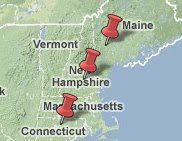
We stuck to the back roads as much as possible, beginning with the rain-soaked, winding pavements of Maine’s lake district and ending with the dry-baked, ramrod-straight gravel roads of Sheridan County, Montana. Our journey took us through the highlands of New Hampshire; the 18th century villages of Massachusetts, Rhode Island, and Connecticut; the rolling Berkshires in western Massachusetts and the Green Mountains of Vermont; the Lake Champlain Lowlands and the Adirondacks of upstate New York; the Saint Lawrence River and the northern shores of Lakes Ontario and Erie; Michigan’s mitten and its and Upper Peninsula; across Wisconsin’s Ice Age Trail; here and there in Minnesota; and west through the prairie potholes of the twin Dakotas. Throughout it all, we kept our feet on the ground and the rubber on the road, riding the thin interface between earth and sky, the place where hydrology happens.
North Shore of Lake Michigan west of Saint Ignace, Michigan.
Intense traffic happened only twice: northwest of Boston near Minuteman National Park, and on “The 401” during rush hour through Toronto. On two occasions, we were completely alone: nearly stuck on a washed-out logging trail in central New Hampshire, and on Route 216 in eastern Montana where we cruised along on a midsummer Friday afternoon without seeing a single stop sign or human being for an hour.
Montana Route 216 between Wibaux and Sydney was the lonliest stretch of the trip.
With Kristine driving, I was free to drink in the scenery and soak up what people were saying. And being a very early riser by habit, I had five hours before checkout time each morning to distill the previous day's experiences and pour them into a daily posting. After reaching the outermost point of the trip, we rode the westerly prairie winds back to Bemidji, Minnesota (getting nearly 34 miles per gallon in a loaded Volvo station wagon). There, I hid for a week in my parents empty house to edit the results into a narrative stream that I hope will be a novel contribution to the environmental education literature.
Walden to Wobegon: A Freshwater Journey from Maine to Montana, is book-length web-journal, written in the anecdotal style of John Steinbeck’s Travels with Charley and William Least Heat Moon’s Blue Highways, but with a tight focus on freshwater. It combines the intensity and quirkiness of a daily diary with the measured pace and uniform style of an edited manuscript. Following the "Preview-Table of Contents," and this Introduction are twenty chapters, one for each day of the road trip. The final chapter is a retrospective written from the perspective of the journey home.
Perhaps you're a fan of crossword puzzles. If so, then clinker, couteau, coulee, aquifer, aquamarine, artesian, pothole, bentonite badland, anhydrous, ammonia, flocculation, fluoride, LUST, limnions, kettles, and catchment are just a few of the words I would have used to design a puzzle from the trip. If you're a fan of literature, then you might enjoy the story of Bob Job from Linton, North Dakota. Were he Shakespeare, he might have written: "To drink or not to drink (water from the Missouri River)....That is the question." If you like mysteries, then you might wonder why there's no pipeline or water truck traffic between Poland Spring and the corporation's bottling plant.
For factual and analytical information about water resources, there are plenty of data-rich, highly vetted, and politically correct documents available from government agencies and scientific organizations. But if those formats are not your cup of tea, I hope you will read, enjoy, and learn from this quirky web-journal.
Monday, June 29, 2009
Day 1 - Bear Pond, Maine
We awoke in the rain. Earth’s most precious substance was dripping out of the gray sky, an auspicious beginning for a road trip devoted to fresh water. Parked above us was a dense bank of low stratus clouds that hadn’t thinned or moved since we arrived the previous evening.
We the People
“We pledge allegiance to the flag of the United States of America…”
With hands held gently over our hearts, Kristine and I recited the Pledge of Allegiance. Never have I heard it given with such an even combination of sincerity and folksiness.
James Adams, 2009 President of the Bear Pond Improvement Association
About seventy people were gathered in the Boofy Quimby Memorial Center in North Turner, Maine. Resembling a warehouse on the outside but decorated in the style of a gymnasium, this all-purpose building was built in 1976 to honor a local boy named Lester Quimby, Jr. who died when he was only eleven years old, the perfect age to pass a Maine winter by playing basketball, and the summer by swimming, fishing, and boating at Bear Pond. I remember being Lester’s age, the chapter in my life coming after the limitations of childhood, but before the awkwardness of adolescence.
Gentle rain drummed the metal roof of the building. Inside, we sat on metal folding chairs like those found in church basements everywhere.
The Meeting of June 28, 2009
The chairs were spray-painted that bland shade of institutional brown, and stenciled with BMC. Straight ahead was a basketball hoop. To the left was a giant American flag, protected from lost dribbles, bad passes, and blocked shots by a rigid sheet of Plexiglas. To the right was a folding table with two half-empty boxes of donut holes and cardboard containers full of "Joe," otherwise known as coffee.
This was a meeting of the Bear Pond Improvement Association, one of thousands of independent, non-profit lake associations in the United States. Each is devoted to protecting its own little slice of heaven. Though Bear Pond is technically a lake, residents here in New England (a.k.a. "greater Lake Walden") insist on calling it a pond. They also insist on calling every waterfront domicile a “camp,” regardless of construction technique or grandiosity. In the Upper Midwest (a.k.a. “greater Lake Wobegon,") all such structures would be called either cottages or cabins, depending on their rusticity.
Just before the meeting, Kristine, a Maine native, asked those behind her if they’d ever seen a bear around here. “Nevah,” came the reply in an unmistakably thick Maine accent. These are local folks, some of whom have been summering here for generations, perhaps since the town was founded in the late 18th century. This place is so old that local lore is divided over how the name Bear Pond originated.
Presiding over the meeting was James Adams, a local realtor about my age wearing a duck-boat-drab colored T-shirt, and who had driven to the meeting in his shiny black pickup. Next was a moment of silence held for loyal members who had “passed on during the winter.” In one case, the family of a recently deceased matriarch, asked that donations be given to the lake association in lieu of flowers and gifts to help protect her favorite spot in the world. That $535 brought the treasurer's balance to $10,930, some of which will be used to buy the water-quality testing equipment now required by the state.
The balance of common loons (Gavia immer), however, was only five, consisting of two mated pairs and an old bachelor male who is allegedly as old as the hills. The chairman of the loon committee, a silver-haired guy named Pete, bore the sad news that their new mother loon had inexplicably left the nest, perhaps due to rising water or molestation by curious teenagers. They also reported that wildlife officials from throughout the state had sent approximately 200 loon carcasses that year to a veterinarian at Tuft’s University for autopsies. Half of these iconic creatures, the doctor reported, died of lead poisoning, either from shotgun pellets or lead sinkers left years ago. Fifteen percent died from entangled monofilament line.
On other environmental issues, the water-testing committee presented positive results, especially with respect to the visual clarity, which was nearly 20 feet using a standard method known as the Secchi Disk. The dissolved oxygen level was good, and the samples for phosphorous had been sent off to the lab. Surveys for invasive species had confirmed that the lake remained free. Finally, the Lesley Wright committee, which “kinda formed yesterday,” reported a plan to keep a patch of donated land “forever wild.”
Bear Pond straddles two sovereign entities, the town of Hartford, which claims 149 house lots, and the town of Turner, which claims 62. Accordingly, regulations are different on their respective sides. Tax assessments are different. Demography is different. But here at the meeting, the only community that matters is the circle of people united by a common love of the lake. Though Maine considers itself a saltwater state, one would never know it from the conversations I heard that day in North Turner.
In terms of development, water quality, and wildlife habitat, the residents of Bear Pond and most New England lakes are lucky, respect to the nation’s lakes, as reported by the recent National Lake Assessment. More importantly, their lake association is in even better shape. Its members neither want nor expect the federal, state or town governments to do their work for them. They give me hope that, one lake at a time, America will return its recreational lakes back to the standard they deserve.
I did have one concern from the meeting. I saw nobody under forty, and most attendees were at least sixty. There was more than enough adult wisdom to go around. But what happens when these folks are gone?
Swimming
The Boofy Quimby Center was the geographic start of our journey, its most northeasterly point. We didn’t travel very far on our first day. In fact, the net distance was no more than two miles: west across Maine Route #4 to the home of Rob and Liz Hoy, my brother in law and his wife. From there, we learned it was a long way to Reserve, Montana, the most northwesterly point of our trip, where some wheat fields are nearly the size of some New England towns.
I asked them to hold up the map I was using to guide our journey: Glacial Map of the United States East of the Rocky Mountains, published by the Geological Society of America in 1959. It remains a remarkably good resource.
Rob and Liz Hoy standing on their deck in front of a small kettle pond and holding up our glacial travel guide in North Turner, Maine.
After the meeting, I asked my grand nephew Calvin what he liked best about fresh water. “Getting wet,” is what he said. It was raining so hard that we could have easily gotten wet just by standing outside. Nevertheless, I had already decided that taking a swim in “greater Lake Walden,”’ would complement the one I plan to take in “greater Lake Wobegon.”
Robert Thorson emerging from Bear Pond, in North Turner Maine.
The water was surprisingly warm for this time of year. Given the high humidity and small size of the drops, the temperature of the rain falling on the lake surface was similar to that of the air itself, in the high sixties. And given he calmness of the wind, this warm water could simply float upon the colder stuff down below. A lake may consist of nothing but water, but that water is usually layered. By late summer, and in deep lakeks, a thick layer of warm, wind-stirred water known as the epilimnion usually floats above much colder water sent down during early spring melt.
Solid Water
Taking in the association meeting on a Sunday morning and leaving early Monday required that we spend two nights up north. Having been fed by my in-laws the first night, I volunteered to cook dinner on the second. This required a round trip of several miles to the nearest grocery store in Turner.
The most exotic place I passed on the way was an antique snowmobile museum. Not only were machines inside antiques, but the museum itself looked like an antique, perhaps not longer visited, or even maintained. Seeing the museum helped me imagine the previous winter. A fluffy mantle of white snow lay upon the ground, its billions of crystals tangled together.
To most people water is something you can drink. Ice is something you can’t. But to scientists, ice, snow, and rain are simply different manifestations of the same molecule. H2O resembles a Mickey Mouse cap, having a pair of hydrogen atoms for ears on one end, and the much larger oxygen atom for a head. On earth, this compound occurs naturally as solid, liquid, and vapor, none of which is more or less watery than the other. In fact, the most common chemical phase of fresh water on earth is not liquid, but ice locked up within the Antarctic and Greenland Ice Sheets. The same is likely true on the Moon. The search for life on Mars is really a search for water, which is really a search for ice. In fact, the word “ice,” from ancient Greek, originally referred to any crystal, even quartz. Ice is indeed a crystal, which makes water in that phase a mineral. This makes ice sheets giant piles of rock soft enough to flow slowly
Snow, of course, is nothing but a fluffy or granular form of ice. soft enough to give way physically, but firm enough to provide some resistance. This explains why the snowmobilers of winter can cavort upon it as do the jet skiers of summer cavort on the surface of a lake.
The sales of snowmobile sales are way down across the nation. Those of jet skis are also in delcline, but holding much steadier. Could this be a harbinger of climate change? Will snowmobiles of the glaciated fringe eventually go the way of typewriters?
Water Businesses
Before reaching the grocery store, I passed two well drilling companies, a construction-excavation company, and at least three sand-gravel quarries. All are connected by the water cycle.
Throughout the glaciated fringe, we can turn on the tap and clean water appears as if by magic. Flush a toilet, and the dirty water disappears. Out of sight, and out of mind. Because most Americans live in metropolitan areas and small cities, few know where it actually comes from and where it goes when they’re done with it. But along Maine Route 4 north of Auburn, the chances are that at least one person in every household I drove by knows about these comings and goings because each is responsible for its own water supply and wastewater disposal. Getting that water requires hiring a drilling contractor, which explains their presence along the road. And in spite of the local competition, they don’t come cheap, which explains why there is competition. A homeowner can easily spend up to ten thousand dollars to drill a household well, and with no guarantees regarding the quantity or quality of the water.
Getting rid of that water is usually even more expensive. Beneath every non-chemical and non-composting toilet in the nation is a drain carrying that which none of us want to see. In cities and towns, those drains merge underground, forming a complex tributary network of bigger and bigger sewers that flow into a wastewater treatment plant. But in Turner, Maine, those individual drains usually head to an underground tank where the solids settle out. The liquid overflow moves out to a series of porous pipes that let the wastewater trickle through permeable soil in what’s known as a septic system.
This is where the sand and gravel quarries come in. If your soil is too clay rich or too dense, a homeowner can solve the problem by importing and spreading sand on the drain field, through which the wastewater can filter and be acted upon by bacteria. The sand there is permeable because it had been rinsed free of mud by flowing glacial meltwater before ending up in flat-topped deltas and on the sand bars of ice-age streams. (consult the Maine Geological Survey for details). Unfortunately, the wastewater is not always rendered pure. In fact, I suspect that a fair proportion of the pollution that reaches Bear Pond arrives from the camps of perfectly nice people who are unaware that their wastewater facility is mal-functioning.
The first night of our trip passed uneventfully. The food was fine, the company pleasant, and the sleep deep.